IN this article we look at the accessibility of Moreton Bay boat ramps from north of the Brisbane River to Redland Bay. Of the 10 ramps covered, only a couple cause dramas at low tide.
Hopefully this article helps you find the best ramp to get into the bay. Remembering the bigger the boat, the more water you draw, and at low tide, trimming may be necessary.
If you put two people on a 5.2m boat versus two on a 4.2m tinnie, the tinnie will go places the bigger boat cannot. Looking at the topography of the bay, the eastern side is all sandbanks, with tidal currents making the only changes, whereas the western side is mud flats, with many areas 00devoid of water on low tide.
The channels across these western flats are mostly man made and often the silt build-up causes low water to get even lower, especially on the big full/new moon tides. What you need are ramps where launching and retrieving on low tides is not full of drama.
Ramps with a pontoon or sandy beach close by to use while parking and retrieving your trailer are ideal, though some ramps require a second person to physically hold the rig while you fetch the trailer. On low tides you want a ramp that ends in deeper water so you’re not churning up mud.
And you want the channel from the ramp to open water to have at least a metre of depth and be well marked for day and night use.
Nudgee Creek (Kedron Brook)
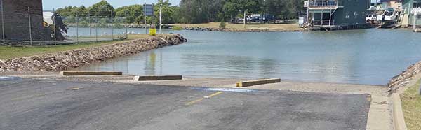
Access to this ramp is gained off Nudgee Rd. The ramp has four lanes with a pontoon up the middle. It drops off into deeper water and has ample parking facilities. At low tide you have to cross the mud flats into Bramble/Moreton Bay and this entrance is very shallow, so a fair amount of trimming is needed and only a few beacons mark the channel.
If you want to access the Brisbane River, once clear you turn right into Koopa Channel, which is well marked, and this brings you out near Luggage Point. On a rising tide you’ll find bait, whiting and sandies on the flats coming through the channel, or you can head to the compass buoy, Brisbane Rd beacons or across to Mud Island.
Pinkenba
You can access Pinkenba ramp from Kirra St on the north side. Southerly wind and wakes from big ships don’t help with launching/retrieving, though there is plenty of parking and playground areas for a family barbecue.
This ramp gives you access to Bulimba Creek, Gibson Island and further up the Brisbane River to the Gateway Bridge.
You can also head downstream to the rock wall near Bulwer Island, the boat passage or the many terminals, but remember the 30m exclusion zone from the wharves.
Colmslie
On the southern side of the river upstream past the Gateway Bridge is Colmslie ramp, which is accessible from Lytton Rd/Col Gardner Drive behind the hockey fields. Here you’ll find a two-lane ramp with a pontoon, a sandy beach on the western side, deepwater drop-off and ample parking.
It can get crowded due to the ferry terminal next door, and people tend to park in the lanes marked for trailers.
The edges of the channel up and down the river feature a lot of rocky structure and fish well for bream, cod, threadies and often jewfish.
Whyte Island
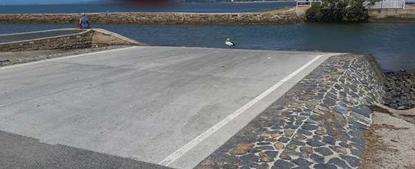
Towards the mouth of the river is the boat passage and Whyte Island, which features a two-lane pontoon ramp and small sandy area at low tide to the south, which helps if the pontoon is full. At high tide, a rocky shoreline prevents this. The ramp is not friendly when a southerly is blowing.
You have two exits here. You can head south towards Wynnum with a well-marked channel that is shallow at low tide but passable. Once past the mangroves, the flats (South Point) on the bay side produce plenty of worms, the odd yabby and soldier crabs.
A left turn past these flats gets you to Mud and St Helena islands (remembering St Helena is surrounded by a green zone). Otherwise, you can fish the Brisbane River and then head out through the mouth into the bay past the coffee pots to Mud Island, the Measured Mile and Moreton Island.
A multitude of beacons at night will have you confused. One thing to watch on high tide is the railway bridge because the clearance can be very tight. Don’t have any rods or aerials higher than the canopy until you’re through.
The flats opposite the water police get shallow, so stay in the marked channel.
Bear in mind this ramp is one of the busiest on the south side, but an overflow parking area exists on the grass behind the carpark. The ramp is under video surveillance from the Port of Brisbane. At present it’s a nightmare getting to the ramp with all the roadworks and detours.
Wynnum Creek
The Wynnum Creek ramp is accessible via Glenora St and provides awesome access to Mud and St Helena islands.
Here you’ll find a two-lane ramp with good water depth at the end. The channel leading into the bay is well marked with reasonable water depth heading out.
This ramp has good wind coverage when launching and retrieving as well as heaps of parking space while being fairly secure. It also gives the smaller boats good access to the shallows down to Manly Boat Harbour.
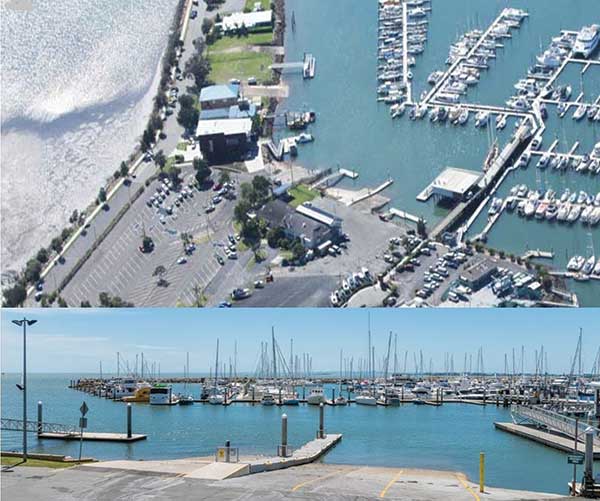
Manly Boat Harbour
This four-lane ramp/pontoon is inside the Manly Boat Harbour along Fairhead Crescent, so it’s well protected, has lots of secure parking and the coast guard is next to the ramp, so there’s no excuse for not logging on. There is a speed limit inside the harbour, but when you exit you simply follow the well-marked beacons out towards Green Island and then turn left or right into the bay.
You can fish the ledges around Green or the drop-off down to Wellington Point. Both southerly and northerly winds churn the water up around Green and into the bay.
Wellington Point
The Wellington Point two-car ramp is accessible off Main Rd, with the jetty running right next door to the ramp.
This ramp has a well-marked channel out over the flats and reef/rubble ledge, which is around the 4-5m mark before it drops off into bay waters.
This ledge runs south nearly all the way to Raby Bay, and in some points you can get up into the shallows and chase bream. Heading north around the (Thorpe and Huyber) beacons on the point, you’ll find two channels and ramps not covered in this write-up (Lota and Tingalpa creeks), which both have well-marked channels as they come out over the extensive shallows into Waterloo/Moreton Bay.
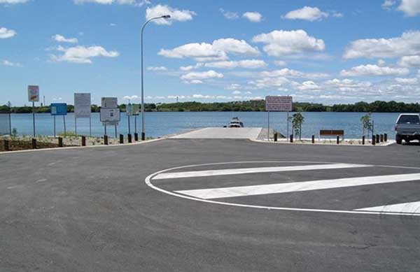
Raby Bay
The Raby Bay ramps are located on William St, with two normal public ramps and a secure ramp for the Moreton Bay Trailer Boat Club. A recent expansion has seen the existing three-lane ramp with its decent water depth complemented by a two-lane ramp just to the south.
Both ramps feature pontoons. The area out from the ramps has good depth but it’s not a big area before it climbs back up to shallow water. Stay in the marked channels until you get to know the area. The foreshore between the northern ramp and VMR wharf is user friendly.
Again this is a busy ramp on weekends with good weather, though you’ll find ample parking. The ramps are used by many offshore crews. Once you clear the last leads out from Cleveland Point it’s a good run across the bay to the top of Peel Island, up the Rainbow Channel and out through South Passage Bar. Strong southerlies and northerlies can churn up the open waters between Peel and the mainland.
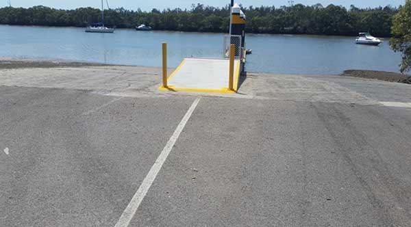
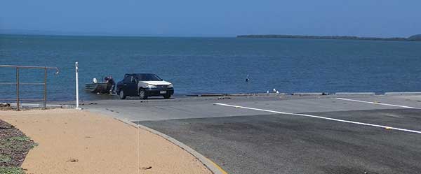
Victoria Point (Colburn Ave)
The Colburn Ave Victoria Point ramp is two lanes with a pontoon up the middle and a reasonable drop-off at the ramp’s end, though don’t reverse your boat too far back or you will strike shallow waters. The VMR is close by and you should find plenty of parking spaces. Both channels leaving this ramp are shallow at low tide.
You can either head out towards the main channel coming up from Redland Bay or go up the western side towards Point Halloran into the bay, remembering that from Point Halloran north towards Cassim Island is a green zone.
This ramp provides the best access to Coochiemudlo Island, Peel Island, Pelican Banks and Blakesleys Anchorage
Good fishing grounds exist arounds the northern side of Coochie and an artificial reef can be fished on the eastern side.
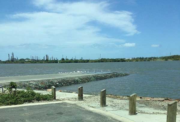
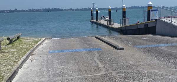
Redland Bay (Weinam St/Banana St)
This four-lane ramp drops off suddenly into Weinam Creek and your trailer is likely to bottom out, so take care when launching and retrieving. There is nowhere to park a boat, so you need two people to launch and retrieve.
The coast guard is close by and the ferry terminal to Macleay and Russell islands is just around the corner from the entrance to the creek.
To exit this ramp it’s best to stay in the marked channel out to Snipe Island and then follow the main channel up into the bay or head to Pelican Banks or Potts Point (Macleay Island), which has reasonable fishing grounds.
The ramp is protected from the wind until you enter the bay.
You can also head south towards Jumpinpin and the bottom of the bay after exiting Weinam Creek. My choice of ramps are Colmslie, Whyte Island, Manly, Raby Bay, Victoria Point and Weinam Creek. I have never used the Lota and Tingalpa creek ramps.
Launching from any of the ramps listed gives good coverage of the bay and rivers. All the ramps are quite boat friendly and the channels have fairly good water coverage on low tides, plus all the boat ramps are secure and many of them have VMR operations or coast guards right there.